BWCA
- June 2010
Page
3: Days 4-6
Sandbar Island to Tiger Bay
Day 4 – Thursday, June 10 – Shortcuts
I’m up early (5:30) and leave at 7:20 to get a head start on the wind. There's a light easterly and a bit of haze and I'm planning to make as much distance as the weather will allow.
On the east side of Snow Bay there’s an unmarked 40-rod portage. The trail is overgrown but clear.
This portage enables me to avoid exposure to the big open water to the north where the famed and dreaded Loch Lacroy monster lurks. I learned about it from someone on the BWCA.com forum. Many thanks! It's one of several shortcuts not shown on most maps. This one is supposed to be open in high water. Given the short climb at the beginning, I'd say the water would have to be at least 6 feet higher than it is now.
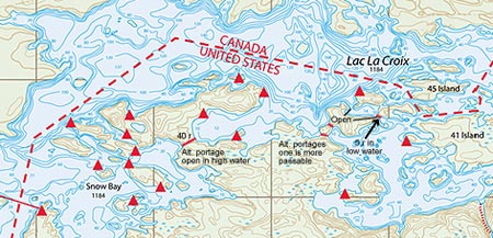
About a mile and a half later I cross a lagoon that is normally open on both ends. The low water creates a 5-rod portage on the east end.
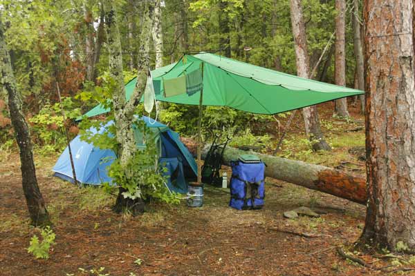
The wind is E-NE at 5-10 with puffs and I expect it to freshen, so I head south of 41 Island instead of taking the more direct route along its northern shore. Then I head north again toward Dome Island. The last forecast I heard was for thunderstorms tomorrow, so I look for a site that offers a good tent/tarp setup as well as good drainage. I check out several sites, including the one at the SE corner of 27 Island, before settling on no. 125 (C0130). The Voyageur map indicates an island, but there are actually two small islands very close to each other, with the campsite landing in the channel between them.
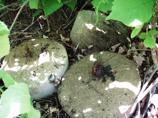
Coming ashore I see three round stones under a bush. I turn them over and they turn out to be anchors. Wha’?
So far I’ve seen a few fishermen, tow boats and float planes, but only two canoes. All the campsites I've passed have been unoccupied.
Day 4 summary:
Total distance 11 miles in 4:45
2 portages of 45 rods in 50 min.
- LLC 40 rods, 40 min.
- LLC 5 rods, 10 min.
Day 5 – Friday, June 11 – Roots of Restlessness
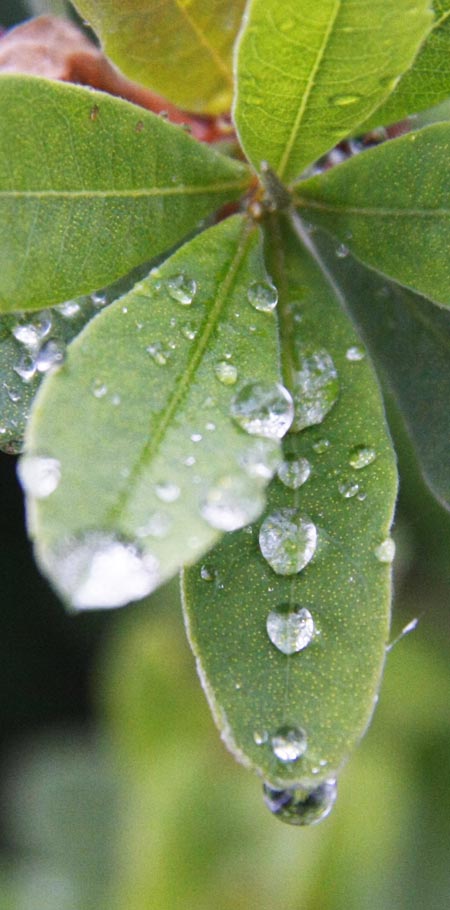
The days have been a mix of sun and clouds. Today it’s heavy overcast with a strong easterly wind and occasional rain. I sleep in, a welcome rest. The campsite and boat are secure.
Today’s agenda: Eat.
It rains all day with some strong winds (15-20+). It’s a good time to settle in and settle down from several days of pushing. I happen to have along a recent sermon by the Unitarian minister, Michael Schuler, titled “Roots of Restlessness.” He begins with a quote from Sylvia Boorstein’s book, “It’s Easier Than You Think”:
“Restlessness is the mind scanning the horizon for the next impending catastrophe. … It is as if the mind, with energy to spare, looks around for potential sources of worry. … My mind has the capacity and the tendency to take essentially neutral data and spin it into worry.”
I laugh out loud when I read this. I’ve never thought myself a worrier, but she pulled my covers. What a hoot! I come back to this theme several times over the next few days whenever I start to fixate on rampaging moose, hungry wolves, and lunatic loons that want to peck my eyes out. Each time I have another good laugh at myself.
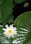
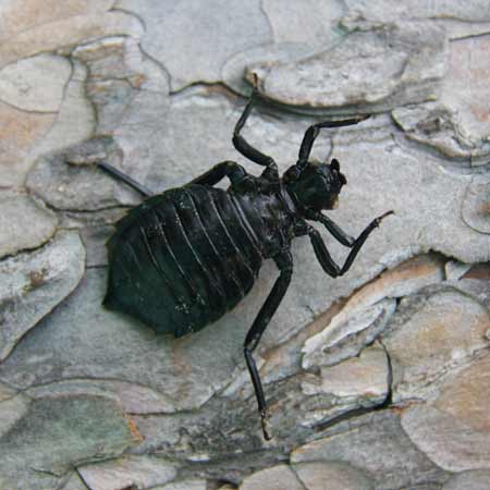
The breaks between downpours offer some photo ops. While checking out the shoreline I find the husk of a big black bug. This thing is about an inch and a half long. It's the shell of some sort of nymph, but it's hard to imagine what climbed out of it.
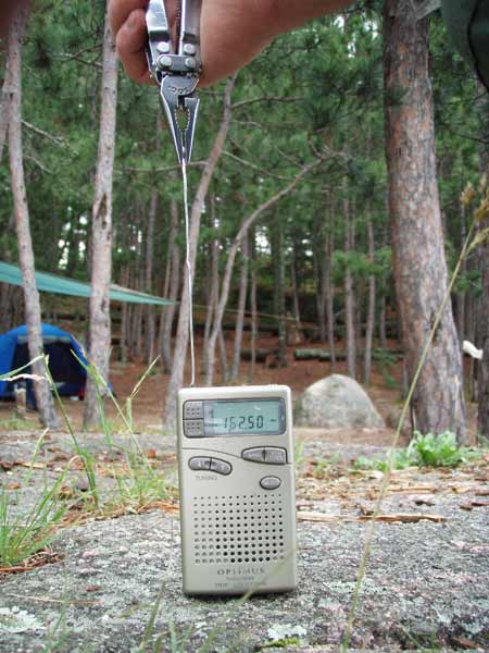
This evening, while catastrophizing about tornados, in desperation for a forecast I stick a piece of wire in the weather radio’s antenna port and pick up the International Falls station. It indicates NE wind 5-10 with a 40% chance of rain. I can't pick up the Ely station but I figure it's probably similar. Being able to get reception is better news than the forecast itself.
Day 6 – Saturday, June 12 – The "Mighty" Lac La Croix Fails to Live up to Its Reputation
Try as I might, it takes longer than ever to break camp and get away. Must be that it’s the weekend.
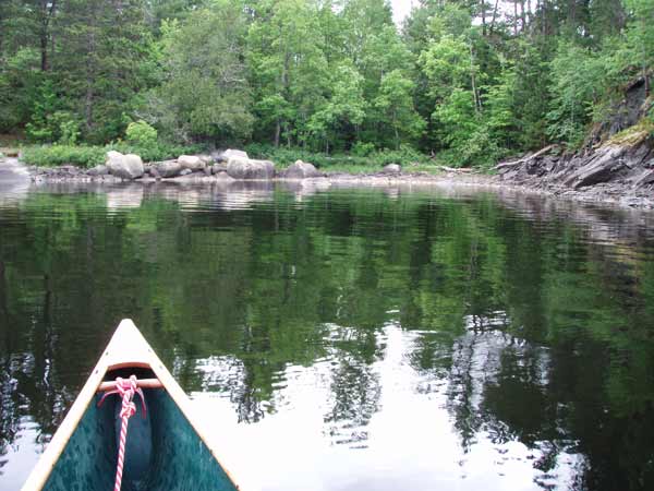
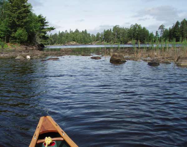
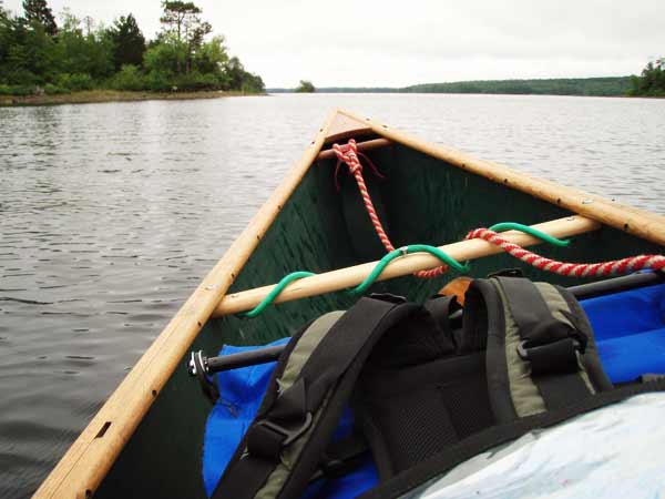
I’m off by 8:15 and paddle into a light headwind. The trek across LLC is uneventful. The worst it offers is 6- to 8-inch waves and only for a few minutes. Mostly it’s pretty calm. It takes an hour flat to cover the 3.3 miles to the channel heading south toward Lady Boot Bay. The Independence is designed for rivers and has a little rocker, so it doesn’t track very well unless it’s heeled. The shot below shows its usual orientation. What I really like about heeling is that it enables me to paddle on one side longer than the four strokes I get with the Prism. It also encourages kneeling, which gives me better posture and a more effective stroke. My back is grateful. (The green bungee cord wrapped around the thwart holds the paddles at the blade end when portaging; the grip ends are held in a velcro strap under the carry thwart.)
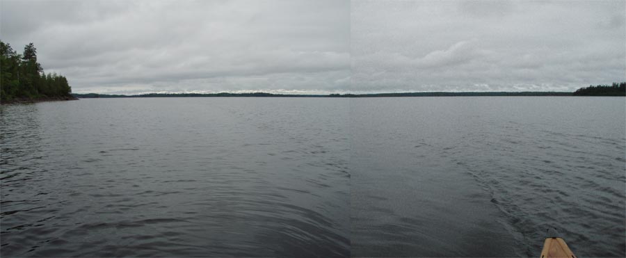
Funny how a nice paddle isn’t conducive to nice pictures. This is looking back across the big water:
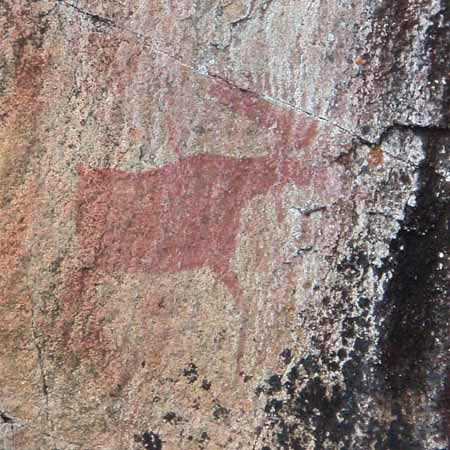
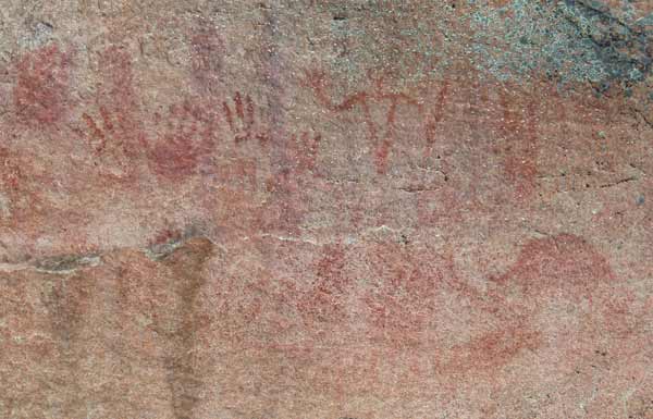
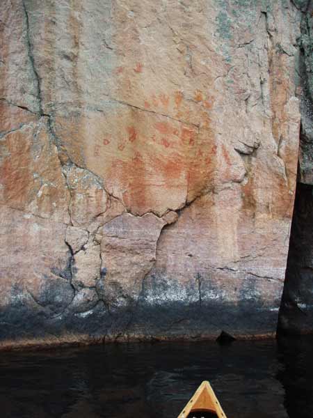
When my son and I went through Fish Stake Narrows in August 2008 it was full. Now it’s strangely deserted. My destination is site 236 (C0167), and I stop to check it out. It would be a nice site if it weren't so obviously overused and had a reasonable tarping option. I’ve gone 9.5 miles but it’s only noon and my paddling mechanisms are functioning well, so I have a quick lunch and head out again for Tiger Bay. En route I take it slow past the pictographs on the Canadian side across from site 239 (C0169) where my son and I stayed two years ago. These ghostly images still captivate and amaze me.
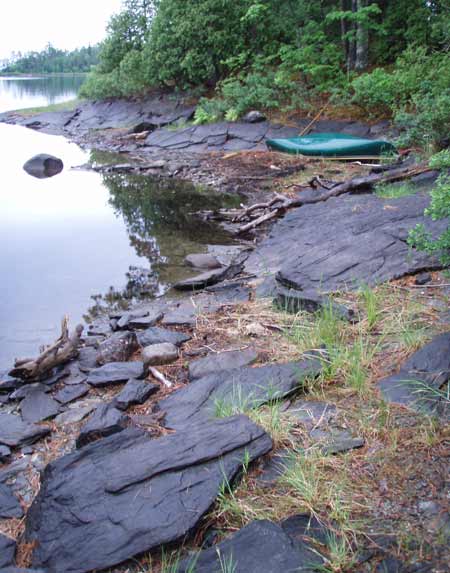
So, what happened to the "mighty" Lac La Croix? Is it just another piece of "essentially neutral data" that people have "spun into worry"? The 3-mile crossing was an exercise in maintaining a straight course on flat water, and the next hour and a half's paddle is even more pleasant. The sun is peeking around the clouds, it's in the 60s, and I have enough shelter from the breeze to get a consistent forward stroke going. That's a good thing because my (probably arthritic) left shoulder is starting to feel the pinch of too much work. I'm heading for the area just north of Tiger Bay, with my sights set on site 369 (C0177). Considering that so far only one campsite I've seen has been occupied, I'm hopeful it will be open. -- NOT! -- So I set up on 359 (C0175), which is a 5-star site for sure.
I feel unspeakable joy to step ashore into an open pine forest with almost no understory growth. I wonder if a bear could find anything to eat here. It’s a kind of biological desert where one species dominates among a fairly small number of total species. For a moment I put my mind away; breathing in, I feel lighter and very free.
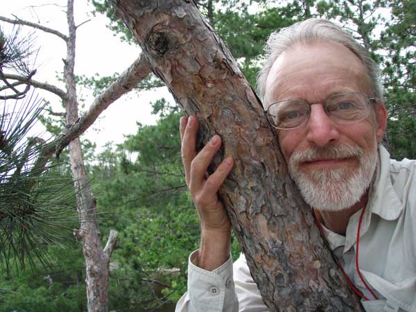
Don't be afraid to hug a tree.
Wrap your arms around it.
Feel its presence within you
and your presence surrounding it.
Put your face against its bark,
cheek to cheek.
Linger a while.
Laugh
- at the silliness of it all
- at the world that would call it foolish
- with the profound joy of connecting.
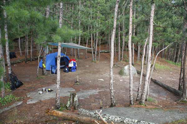
The gear can stay packed a while. This place is too nice to start setting up right away.
But eventually my house is built.
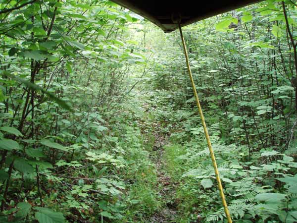
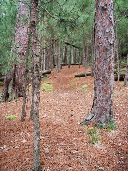
The trail to the latrine is unlike any I’ve seen yet.
I take another stab at the weather radio. Using a key ring and my multi-tool I fashion an antenna that actually works. It picks up the Ely weather station so now I can get inaccurate forecasts from closer than International Falls.
FINALLY I bathe and take a shower. Sorry, no pictures. I don’t want to break the camera.
Rain started about 7:00 but didn’t last long. Still no bugs.
This was a good day paddling – covered 14 miles – but I’m paying for it with two sore shoulders. They bother me off and on the rest of the trip. I'd take ibuprofen if I had any left. It's been used to treat sore muscles.
Day 6 summary:
Total distance 14 miles in 5:00
Tomorrow:
On to Lake Agnes
Previous
Back to top
|